
Geological mapping and structural analysis from satellite imagery of a section of the Adamawa Massif: Implications for mineralization
Keywords:
Geologic Mapping, lineament, satellite, imagery, joints and mineralsAbstract
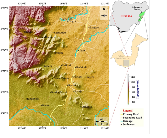
This study provides a comprehensive geological mapping and structural analysis of lithological units within a portion of the Adamawa Massif in northeastern Nigeria, emphasizing their implications for mineralization. Using a scale of 1:50,000, we identified ten distinct lithological units, predominantly belonging to the Older Granites suite, which reflect the Pan?African Orogeny. Lineament density was quantified as the number of lineaments per grid?unit area and classified into nine spectral bands ranging from 0 to 4. The 214 km2 study area was divided into 15 equal grid cells. Four of these cells, located in the northwestern mountain ranges, exhibit high lineament density and encompass 57.08 km2 (26.7 % of the total area). In contrast, the remaining eleven cells, characterized by low lineament density, cover 156.97 km2 (73.3 %). The highest?density category (Band 7) occupies only 14.27 km2, amounting to 10 % of the study area. Structural trends in the region are primarily NNW–SSE and NNE–SSW within the banded gneiss, and NNW–SSE and N–S within the medium-grained granite. These joint systems serve as potential conduits for mineralizing fluids, underscoring the area’s prospective mineral resources.
Published
How to Cite
Issue
Section
Copyright (c) 2025 Solomon Nehemiah Yusuf, Williams Midala Wakili

This work is licensed under a Creative Commons Attribution 4.0 International License.